February 20, 2009

Some brief thoughts

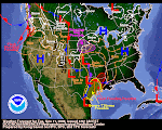
As you can see from the above latest QPF graphic, NORCAL is in line for some impressive new precip--over 5 inches if the weather wonks are correct. Idaho is once again on the outside looking in.

I'm taking a break from posting here on the Winter0809 Blog until Sunday. We're going to a Dog Sled Derby about an hour north of here tomorrow. Hopefully, I will dream up something for Sunday School.

In the meantime, I'd suggest you take a look at the jetstream--it's very fractured and contorted and weird looking. Likewise, seek out the global water views--Asian continues to package and ship some impressive globs of water vapor. Also, please glance at the 6-10 and 8-14 day forecasts on the CPC link. They are both showing above normal precip. In other words, you've all learned how this drill works---do you own forecasting now!

And, just for grins, Google up Mount Redoubt and keep an eye on it, too. Heck, if you do all that stuff, who needs me to write anything here anyway?

Have a great evening and a wonderful Saturday--we will see you Sunday! Cheers, JP

February 17, 2009

Our Sun.

We are smack in the middle of transition between two Sunspot Cycles. Right now the solar disk is abnormally quiet. "Sun watchers" are getting antsy. No one knows when the sun will switch gears and start exhibiting signs of the new cycle. In the meantime, all eyes are on the sun. ANYTHING that happens on the solar disk is subject of much discussion. And so it is today with this activity. It may not be the stuff of solar storms. It may not be capable of producing a brilliant aurora. But it sure is fun to see.

Why are WE watching the sun, anyway? Well, Bubba, here's the bottom line: when all is said and done, Ol' Sol is our "weather maker." What happens on the sun makes its way to earth and affects our weather. You can take those words to the bank! That's why we watch the solar disk every day of the year, at least when we can get to the internet.

As the sun goes, so goes earth!

February 16, 2009

Just how is Alaska, anyway?

I haven't had time to check in on Alaska lately. I've assumed it's cold up there. I noticed on the NWS Warning composite that the North Slope is under a Blizzard Warning. So I clicked off and, sure enough, it's gonna be your typical way-be-below zero temps with fierce winds and lots of snow. Hum...sounds intense! Meanwhile I clicked off into the Bering Sea and, well, yeah, 50 knot winds, 20+ foot waves.
It's not so bad in the lower Alaskan latitudes--just a normal winter. However, it's a good idea to keep an eye on Alaska. If it gets tropical up there, I'd guess the affects of the summer volcano ash and gas are history. It looks like Ol' Man Winter has Northern Alaska by the throat right now. Cold. Snow. Wind. High Seas. All the usual suspects.

It all depends...

Whether our weather will continue this pattern into March depends on the jetstream and the water vapor supply. Right now, it looks good. As you can see, I've annotated today's jetstream to show the Northern Hemisphere symmetry. Remember that "wagon wheel" analogy I used quite some time ago? Well, this is as symmetrical as the wagon wheel spokes get! The jetstream is exhibiting some real nice behavior in this graphic. Meanwhile, the water vapor production (see below)continues to look good. Siberia is very generous to us. That on-again, off-again subtropical tap shows promise as well.

As you may recall, we started this blog many moons ago on the premise that the Summer 2008 Aleutian volcanic eruptions were going to distort our Northern Hemisphere winter weather patterns. I think we can all safely agree that those patterns have helped produce a real memorable winter. Whether it was due to the volcanic factor will be the topic of much discussion as the climatological postmortems are rolled out in the months ahead.Let's assume for a minute that the volcanic factor was, indeed, at the root level of this winter's interesting weather. If so, the question becomes: "Have those volcanic factors diminished?" The answer would be "Probably." It takes many months for the gas and ash to disperse enough to lessen its impact on deflecting solar energy back into space. However, I'd be inclined to wager there's enough of it left to eek out another 4-6 weeks of solar energy disruption in the far northern latitudes. Maybe less, maybe more. So, if we carry that line of speculation forward, I'm beginning to be inclined to think that March could be a Pretty Good Precipitation Producer. Maybe I should coin an acronym for that--PGPP.

The wild card in this deck remains Mt. Redoubt. So far, it's been a real dud--a little steam here, a little rumble there but nothing remotely resembling the early dire warnings issued by the Chicken Little Volcano Heads. But you never know--a volcano has its own clock that's ticking its own time. We could wake up one morning to a major motion picture on the CNN Headline News. There could be ash and gas getting shot 40-50-60,000 feet into the polar latitudes.

I can tell you one thing pretty much for sure. If Redoubt blows it's top, there's no doubt we're in for a cold, wet spring and probably a cold wet early summer as well. That's where the wild card lies.

When's the party over?

The screen shot on the right is the overall QPF for the next five days. The left shot is the current NWS warning composite as of Monday morning. That Winter Storm Warning coloration pretty much covers most of the Sierra Mountains. During the next five days, the same area is progged to get almost 3 inches of precip. Meanwhile, the 8-14 forecast shows above normal precip for a wide area of the West.

Our next post will (above) will take a look at the water vapor patterns and the jetstream. The question arising now is "when's the party over?" No pattern persists forever. The first day of Spring is less than five weeks away. In the past few years, the party's ended right about this time of year. In the Good Ol' Daze, March could be a real weather & water producer. Will the good times keep rolling right into March? Fourteen days puts us into early March!

February 15, 2009

Tell it like it is!

Hey, those Reno weather wonks are gettin' some ATTITUDE! Check this snippet from the 7:26 pm 15FEB AFD:

"NICE WARM CONVEYOR SHOWING UP ON 290-300K ISENTROPIC SURFACES EXTENDING FROM OFF THE COAST TO TAHOE/LASSEN. AS FAR AS MODELS GO...HAVE TOSSED THE NAM IN THE TRASH FOR THIS STORM. IT HAS NOT HANDLED THE POSITION OF THE BAND WELL AT ALL SINCE FRIDAY AND WAS EVEN DRY FOR TAHOE UNTIL 21Z TODAY?!?!?!

Yeah, "TOSSED THE NAM IN THE TRASH!" Right ON, Bro! Sometimes these NWS people pay WAY too much attention to their models. They wring their hands and agonize about what the models "mean." It grows old and annoying sometimes. It's refreshing to read how somebody in Reno simply said, "Throw the SOB in the TRASH!" Yeah, that's my kinda attitude!

Lately, Reno gets my vote as the "GOTO" place for an exciting AFD. They will probably soon get called on the "Climo Carpet" for all their enthusiasm and straight talk. But, hey, let's enjoy it while we can.

Spaceweather

The photo above is just a reminder to visit Spaceweather often. Don't forget! That website simply ROX~!

Sunday School has Visual Aids!

Hey, there, Class, Thanks for showing up for Sunday School this morning! As promised last week, we're going to walk you through the new-fangled NRCS method for finding out the "percent of average" of any given watershed snowpack. It used to be pretty simple. But you know the gubmint motto--"if it ain't broke, change it!" The new method is pretty good but I miss the old graphs-at-a-glance. This one's OK and I guess I will get used to it. Maybe you will, too. Whatever the case may be we gotta "dance with the one that brung us" and, in this case, that means the good ol' NRCS.
Ok, this Sunday School is gonna be real short and, hopefully, sweet. Why? Well, it's bright and sunny outside and I am itching to git outdoors and "get a life." That's why!

You begin this process by clicking on the NRCS link in the left hand column. By now, you should now that drill. Then you will have to follow some steps that aren't really too complicated. However, there's enough steps that you can get lost and take a wrong turn. That's why I made these graphics below. Just follow the steps and tailor your final approach for whatever state-of-mind suits you and then you're cleared for landing on Runway 0809! Have a great day. Study your Visual Aids, practice a little bit and then GO PLAY!


PS--I forgot to mention that one nice thing about the new format is that you can get the "percent average" for any given day, including today, February 15!!! That's actually pretty cool.