In spite of the copious gifts of The Great Winter 2008-2009, California has been left out. They are in a "world of hurt" right now waterwise. It looks real grim for California. So grim, in fact, we won't even attempt to make jokes or puns about it. Click here to read just how grim it really is. Grim is the word of the day there. Grim & bear it.
(Added 01FEB-Edited 02FEB)If you click on the QPF link at left, you will see the 5-day shows California getting some precip. A little more than 1 inch of water is progged for parts of the Coast Range. Water falling in the Coast Range doesn't help much. The Climate Prediction Center's 6-10 forecast confirms the QPF projections. Don't forget to check the CPC's website at least once a week.
January 30, 2009
What's on tap?
It's time to talk about what might be upstream heading our way. The high pressure over the West doesn't seem to be as strong or persistent as January's earlier mid-winter break. I'd suspect this high will move east soon. Meanwhile, another good pattern is shaping up for possible transport of lots of water onshore. The equatorial latitudes are beaming up a real nice plume on the "southern track." Siberian is also doing its duty and pipelining a rather consistent looking plume on the far northern track. Meanwhile the middle track looks like it's setting up a shipment, too. In football this might be called "the West Coast Offense." I'd suspect that one or more of these vapor plumes will be making news sometime next week.
January 29, 2009
When in doubt-Redoubt!
(Edit #5 31JAN09 8:30 pm)You are all up to speed on Mount Redoubt--no doubt! It's going to blow. It's not a matter of if, simply when.
In the meantime, perhaps this would be a good time to review "volcanic lightning. Yep, there really IS such a thing! Google it and then select "images." The above image is that Big Volcano in Chile whose name I can never spell or pronounce. From what I've been reading, it's a major motion picture show!
OK, back to Redoubt. In case, you've been sleeping under a basalt rock, Redoubt's a big volcano 100 miles upwind from Anchorage. It's last eruption gig spanned from December 1989 to April 1990. It also erupted in 1966 and 1902. This particular volcano has the potential to really shake up North American weather patterns.
A Google News search using simply the word "Redoubt" will yield hundreds of articles.
Here's a pretty cool article from late Saturday evening.In a column called "Talk of the Tundra," a writer lists a long bibliography about Redoubt.
The northern latitudes are already still filled up with a major dose of volcanic gas from the 3 Aleutian volcanic eruptions this summer. All that gunk is still up there. That's the primary reason it's been so much colder than normal up there this winter. Here's a nice NASA link on volcanic cooling. The Alaskan Volcano Observatory is taking this event very seriously. As of Friday morning the AVO's web servers were totally overwhelmed and the site was inaccessible. As of Saturday morning AVO was back online and fully functional.
I've been reading about Redoubt's impact on the Cook Inlet oil facilities back in 1989-1990. Get this: at it's peak flow, the Drift River was running 2.1-MILLION cfs! That is more than the Mississippi. Here's where I read those figures.
January 28, 2009
A Mild Future is in Store
It looks like we are in for a mild future. Not a Bluebird phase, perhaps, but at least a pause from the mayhem of recent daze. We've been pretty battered here lately by snow and cold. Susun and I joked today that driving the local streets felt like four wheeling in Custer County! Of course, we don't have a four wheeler here and we're driving on summertime tires. So take our assessment with a grain of snow.
As you can see by Thursday's 5-day QPF forecast, it looks totally dry across the West. Perhaps the Tetons will get a few more inches of snow. These same QPF graphs from a few days ago sure turned out to be spot on.
Idaho Falls is definitely "under the spell" of winter. Whatever you do here, where ever you go, you are aware that the slightest slip up will result in a jarring fall on ice-covered concrete or asphalt. This morning I wore Yak-Trax on my boots when I snowblowed the sidewalks. People we know here are walking very carefully each with each step--they know the cost of a slip up. Yea, verily, this is what it means to have an "epic winter." We're not complaining--it's a good thing!
January 27, 2009
Happy Trails, Frank!
One of our dear friends, Frank Protiva, was killed last Friday morning when his 1963 Cessna 205 crashed in trees about 15 miles south of Flagstaff, Arizona. Frank was one of the 5 "Followers" of this Blog. He was an avid weather watcher and we exchanged many great emails about "The Great Winter of 2008-2009." You can click on his picture at left to read his official obituary. I will be creating a memorial page for him on my personal website. Since we was a genuine Follower of this blog, I thought it was only fitting that he should have a little memorial here, too. NOTE: When this post moved off the front page, we took down Frank's photo and the link connected to it. It's going to take us at least a day to reconnect the photo, the post and the link to his obit. Don't worry, it's on our radar. Thanks for your patience. j
Kinda cold here
Surprise! The overnight low here in Idaho falls reached 29 below. Clouds moved in and as of dawn the temps had rallied to only maybe 8-10 below. Click here to see the blow-by-blow data.
January 26, 2009
Fireball
You may have read about the fireball in Sweden about mid-month. I know it's not really related to winter weather here but I'd like to preserve the best known video of the fireball for posterity.
January 25, 2009
Los Niños
It's Sunday School! Yippee! OK, Welcome to Sunday School. Today we're going to talk about a couple of Golden Oldies: El Niño & La Niña, AKA Los Niños. You've all heard their names a thousand times since they were "discovered" back in the 1980's. The books, papers and articles written about Los Niños would probably fill a skyscraper.
As the years have passed, Los Niños have become a legendary part of global weather lore. It's been a long time since I've seen a simplified explanation of those two terrible children. Well, lo and behold, while we were roaming El Net this morning we quite literally stumbled onto a very nice and simple description and discussion of Los Niños. Click here to go to the NWS Pacific Regional HQ's "ENSO" page. Then click the "Next" button at the bottom of that page, and viola, Sunday School comes alive! OK, Class, we'd like to call your attention to something called the "Niño 3.4 Zone." Click on the tiny graphic here and you will see it between latitudes 5N and 5S and between longitudes 120 and 150 West. The NWS says this zone "is the preferred region to monitor sea surface temperature" for the purposes of monitoring ENSO and therefore Los Niños. Now, Class, go click over on the SST link at your left. Take a real close look at the Niño 3.4 Zone and tell me what you see. Hum...that's right, Class, you see cooler waters! NOAA & the NWS have this little gig where they won't declare either an El Niño or La Niña until they have months of data to back up their claims. Often, I've noticed that either of the Los Niños is clearly visible long BEFORE the scientists say it's "official." I am getting an inkling that such may be the case right now. I've heard vague rumors that a "weak La Niña" is possible for this year. (Check this Anchorage article.) I'm beginning to think those rumors might worth listening to. Keep an eye on the Niña 3.4 Zone in the weeks ahead. If you see a wider area of cooler water and a cooling trend, I think you might wanna lend some credence to those rumors! Thanks for attending Sunday School. Now GO PLAY! (PS--We are now moderating comments so there will be a time delay between when you comment and when it shows up. Sorry 'bout that!)
YMMV
YMMV is texter-talk for "Your Mileage May Vary." It's relevant today in context of recent snowfall. Precip has been pretty fickle in Eastern Idaho. Island Park barely picked up a half inch of precip and only a few inches of snow. Meanwhile Pine Creek Pass fared better, gaining about 10 inches of snow. The real winner is down in Napoleon Dynamite Country in the high country of the Idaho Wasatch east of Preston. That area got 2.5 inches of snow water equivalent and danged near another couple of feet of snow! Sunday morning here in Idaho Falls is fully decked in stylish Winter Gray. It's foggy and cold with lots of sloppy snow strewn helter skelter every which way but loose.
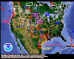
OK, let's talk about the graphic in this post. When's the last time you've seen such a "busy" weather map? Looks like they almost ran out of space to draw their little arrows and make those funky circles for heavy snow. I often wonder if making those maps is like playing a video game like Guitar Hero or Grand Theft Auto. Maybe when those head-phone clad Weather Wonks are hunched in front of their computer screen, they are actually rocking out to Def Leppard or grooving on Squirrel Nut Zippers. Who knows?
Subscribe to:
Posts (Atom)