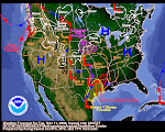
A regular series of Pacific storms continue to affect our Northwest weather. The daily QPF graphs look remarkably the same each day. The US Navy water vapor photos also seems to be clones of the previous day. The NWS chatter in their various discussions is sounding like the proverbial old broken vinyl record. Idaho Falls has enjoyed a few days above freezing but it looks like we're in for another cold snap. Here's the AM Pocatello AFD snippets:
LATEST IR SATELLITE SHOT SHOWING CLOUDS AND ASSOCIATED PRECIP DUE TO OVERRUNNING. QUITE UNBELIEVABLE OVERRUNNING IN FACT AS TEMPS THIS MORNING RANGE FROM 44F AT BURLEY...44F AT CHALLIS...AND 34F BEING REPORTED AT STANLEY. SNOWFALL AMOUNTS
EXPECTED TO BE 10 TO 14 INCHES IN SAWTOOTHS WHILE UP TO A FOOT EXPECTED IN EASTERN AND SOUTHERN HIGHLANDS. ANOTHER CONCERN ARE THE WINDS. 120KT JET PROGGED TO MOVE OVER REGION THIS MORNING AND IN RESPONSE...HOWEVER...NOW MUST CONTEND WITH A REMARKABLE TEMPERATURE CHANGE. HI TEMPS ARE EXPECTED TO DROP ROUGHLY 30 DEGREES BY SATURDAY WITH LOWS BELOW ZERO IN MOUNTAINOUS AREAS AND SINGLE DIGITS ACROSS REMAINING REGIONS.
The primary beneficiary of this pattern is the Upper Snake River watershed. It is beginning to look very favorable for the 2009 water supply.
January 2, 2009
December 30, 2008
Deja vu?
Phil: Do you ever have deja vu Mrs. Lancaster?
Mrs. Lancaster: I don't think so, but I could check with the kitchen.
Above is one of my favorite quotes from the movie Ground Hog Day. Bill Murray is in the dining room of his B&B. Well, in this case our weather deja vu is all coming from the same kitchen right now--Siberia. Big Wadzillas there are ganging up and rolling offshore to bluster across the Pacific and splatter the Northwest with fat gobs of rain, ice and snow. The pattern looks to continued abated for awhile. Today's QPF graphic looks almost exactly like one from a few days ago. Deja Vu? You betcha!
Meanwhile, one of the Jackson ski resort restaurants sustained avalanche damage yesterday. It was a front page story in the Idaho Falls paper. They claim to have rec'd 5 feet of snow in 7 days. Avalanche deaths are soaring, 9 since 14DEC, plus another 8 in Canada over the weekend.
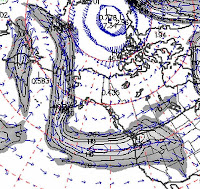
The jetstream has gone zonal--basically that means Old Man Winter is blowing full force in a straight line right smack across the Pacific. No dipsy-doodle whippy kinks and bends for the jetstream right now. Don't worry, though, they will be back!

People really begin to pay attention to the gubmint's snow data as of 01JAN each year. That's the first report that really matters. The US NRCS will publish monthly Snow Reports for each state January through May. Click here for a tremendous narrative summary of the NRCS Snow Measurement & Reporting program.
Mrs. Lancaster: I don't think so, but I could check with the kitchen.
Above is one of my favorite quotes from the movie Ground Hog Day. Bill Murray is in the dining room of his B&B. Well, in this case our weather deja vu is all coming from the same kitchen right now--Siberia. Big Wadzillas there are ganging up and rolling offshore to bluster across the Pacific and splatter the Northwest with fat gobs of rain, ice and snow. The pattern looks to continued abated for awhile. Today's QPF graphic looks almost exactly like one from a few days ago. Deja Vu? You betcha!
Meanwhile, one of the Jackson ski resort restaurants sustained avalanche damage yesterday. It was a front page story in the Idaho Falls paper. They claim to have rec'd 5 feet of snow in 7 days. Avalanche deaths are soaring, 9 since 14DEC, plus another 8 in Canada over the weekend.
The jetstream has gone zonal--basically that means Old Man Winter is blowing full force in a straight line right smack across the Pacific. No dipsy-doodle whippy kinks and bends for the jetstream right now. Don't worry, though, they will be back!

People really begin to pay attention to the gubmint's snow data as of 01JAN each year. That's the first report that really matters. The US NRCS will publish monthly Snow Reports for each state January through May. Click here for a tremendous narrative summary of the NRCS Snow Measurement & Reporting program.
December 28, 2008
Wadzilla?

Hum...that's one heck of a wad o' water vapor out there in the Pacific. It's heading our way. We nicknamed it Wadzilla.
Meanwhile, the jetstream is having more fun than a contortionist at a ten cent circus. It's got itself an actual 90 degree kink in it.
 Normally, the jet rocks and rolls with a wavelike action--getting real angular, so to speak, just ain't part of the jetstream's life plan. It won't last long so enjoy the anomaly while you can.
Remember, you can click on any image on this blog to see a larger version. The Blog Gnomes automatically shrink images down to tiny little files. The larger original lives under the Gnome Bridge with the Blog Troll.
Chetco rose 15 feet

Well, the Chetco is probably a river you've never heard of. It drains down out of SW Oregon's Coast Range and meets the sea at Brookings in Curry County, Oregon. We camped on the banks of the Chetco for a few days back in 2002. These coastal streams are very accustomed to sudden high flows. The Chetco rose a total of 15 feet and reached a peak flow of 51,000 cfs. Only minor flooding damage was sustained.
How do you find this stuff? Good question. Google "Oregon Real Time Stream Flows" and then scroll all the way to the end of the list. There is it like magic.
Silverton was no fluke
Sunday morning we are roaming the SNOTEL sites looking for Big Snow. The "Upper San Juan" site in SW Colorado caught our eye. This site is actually Wolf Creek Pass on US Highway 160 NE of Pagosa Springs. It actually is the very tippy top of the San Juan River headwaters. River runners get giddy & goofy when Wolf Creek has a lot of snow--it's means "The Juan" will be a hot ticket during upcoming runoff. Well, back to the story: This SNOTEL is sitting this morning at 81.7 inches of snow. Yesterday was 87.9. That's considered normal settling in deep snow. The interesting factoid is that the site gained 36.4 inches of snow in five days! That translates to a gain of 7.1 inches of SWE, AKA Snow Water Equivalent. SWE is the real water that's hiding in the snow.
We had a question recently on how to find this data yourself. It's pretty easy. Click on the top link at left--the one for SNOTEL Sites. On the right side of the new page you will see a link Snow Depth called "Products." When you click there, you can get a text summary of the snowdepth at all sites within any given state. After you find a particular site of interest, return to the main SNOTEL page, click that state, choose the site that caught your attention and then click on "7 Day Snow Depth" by either hour or day. It's really quite simple once you get the hang of it.
One other cool thing you can do is find the SNOTEL site on a satellite, terrain or highway map using Google Maps. Each SNOTEL site has long-lats. Plug them into the Google maps search field and, viola, there you have it! Click the example below for a larger version.

Subscribe to:
Comments (Atom)


