February 14, 2009

More focus on California

Here is some really strongly worded language:

"California is facing the most significant water crisis in its history. After experiencing two years of drought and the driest spring in recorded history, water reserves are extremely low. With the Sacramento-San Joaquin Delta ecosystem near collapse, court-ordered restrictions on water deliveries from the Delta have reduced supplies from the state's two largest water systems by twenty to thirty percent.

Drought conditions in the Colorado River Basin and a Sierra snowpack that is now dangerously unreliable due to global climate change, is leaving many communities throughout California facing mandatory restrictions on water use and/or rising water bills. If the drought continues into next year, the results could be catastrophic to our economy." Go to the website where we found this snippet.

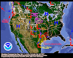
The above map linked from the Climate Prediction Centers says it all--NORCAL is at ground zero of a genuine water crisis. Right now, tonight, even as we write this blog post, NORCAL might just be getting a "get out of jail" pass and California might dodge an intergalactic bullet. NORCAL is getting plastered tonight.
It's awesome, it's epic and it's great!
Above you see the water vapor blanketing the most hard hit part of drought stricken California. Below, you see a screen shot of the next few days of accumulated precipitation this area. At this point in time, it really can't get a whole lot better than this!

Da BUOY

We wish to encourage our Dear Readers to check "Da BUOY!" NOAA and their cohorts run a first class buoy operation spread all over the far flung ocean surface. When you see something happening on a Navy water vapor, run along and check Da BUOY!

It sure looks like that big Wadzilla up north is huffing and puffing its way into a happening deal. Some of the winds up there early this morning were yawners and now they are gusting to 40+ knots. The wave heights haven't picked up too much, maybe 10-13 feet but the winds auger for an increase in the waves, too.

With the internet and satellite technology we have now, there's no excuse for not beaming into every little nook and cranny that you can. Ocean buoys are a priceless resource. Check 'em out!

Wild West Jet

Today's jetstream diagram reminds me of either rodeo or some scene from a 1950's black and white Western shoot-'em-up. It's rip snortin' and rarin' to go! It's been quite a long time since I've seen anything this shredded in the jetstream. Heck, it might even be Jetstream Triage! Where do you look first to analyze and "treat" the situation?
Meanwhile, a glance at the water vapor situation this morning says that we're still on tap for a few more waves of water to wash ashore. The Western Pacific shows that is is attempting to reconnect its firehose the Phillipino hydrant. If we get that subtropical connection going again, WHAA--WHOOO!!!!

NORCAL is getting smacked hard as we write this, high winds, rain, snow, the whole buffet of winter jingo and major lingo. Ironically, it's NORCAL that shows up the "reddest" in gubmint's drought diagram. This type of action almost certainly will alleviate the severity of that situation.

To see it unfold, if you're interested in such stuff on a lazy Saturday morning, here's what I would recommend. First, click on the National warning map at left. Then click into one of the little colored areas up in NORCAL. Have fun reading about all the mayhem. Then start Googling various community newspapers and TV stations in that region. That should keep you entertained at least until lunch time.

February 12, 2009

A moment of truth

All eyes and hopes are on California right now. Californians might not know or realize it but lots of humans elsewhere are praying that they pull through the epic drought that they are facing. Their best odds are coming up in this next pulse and parade of storms.

I was roaming the various AFD's this evening and I found a rare bit of personal emotion being expressed. Normally, the NWS weather wonks keep their personal feelings out of their discussions. It's all "cut and dried" techno talk.

This snippet came out of Reno's afternoon AFD. You can almost sense the helplessness and near hopelessness in these words, as well as a sense of prayer, too. Maybe I am reading too much into a few scant words. I don't think so.

IT IS VERY IMPORTANT TO NOTE THAT THE 18Z RUNS...AND 12Z EURO ARE ALSO TRENDING SLOWER AND A BIT DRIER. EVEN WITH THE DRIER SOLUTIONS...1-2 FEET OF SNOW FOR THE SIERRA STILL LOOK POSSIBLE...BUT NOT THE 2-4 FEET INITIAL INDICATIONS SHOWED. IT IS EVEN POSSIBLE IF THE LOW CUTS OFF ENOUGH THAT WE DONT GET THAT MUCH AT ALL. RIGHT NOW...MY GUT FEELING IS THAT THE 12Z EURO/18Z GFS IS THE WAY TO GO...ALTHOUGH MY CONFIDENCE IS NOT ALL THAT HIGH. GIVEN THE WAY THIS WINTER HAS GONE...ALMOST EXPECTING THAT I AM STILL TOO WET. I HOPE I AM NOT. WALLMANNCheck out Buoy 46002--Gusting to 39 knots--waves to 20 feet! YES!

Precip perks up

Well, this graphic is pretty self-explanatory. If you've been watching what we've been posting, you can quickly note the quantum leap in precip in this graphic. It's huge--almost Reichter Scale!
Wow--are the Rain and Snow Gods being "nice" to California or what?

It's been a long time since we've seen California in the "red zone" of a precip event. Ignore the five inch area for a moment and look inland in the Northern Sierra and you're seeing 4.0-4.6 inches of precip. If the dynamics are correct that could translate to 3-4 feet of SNOW! That's HUGE!

February 11, 2009

GFS animation + Accuweather drought story

We all read a lot about the models that the NWS Staff uses to make their forecasts. One of the primary models is the GFS. Click here to see it's progression of storms hitting California. It's real impressive!
Well, well, well! I went to Accuweather tonight simply to type in the Idaho Falls Zip Code to get tomorrow's forecast. Lo and behold, they posted a story about 7 pm tonight saying that the California drought might be coming to an end! Hey, it's great to have somebody like Accuweather saying this. YAAA-HOOO, I don't feel like the Lone Ranger any more. (The link posted yesterday no longer works.) I snagged one of their photos because I like the way it looks. Kinda art deco in a retro-lineal sort of way, eh?

All ashore!

Here are the twin Northern Hemisphere views courtesy of the US Navy for Wednesday morning. I don't have time to draw little funky lines on them today. I wanted you to see them without having to surf around the Navy website. Also, I wanted to archive them for future reference. Note the CPC's 6-10 day forecast below. (Click on the little one to see the big one.) It has California right smack in the crosshairs of all the incoming action from El Pacifico. I am already beginning to wonder if these great "gifts of the sea" might not change around the urgent drought dynamic facing California. We're talking a lot of water progged for California. We're talking rain and snow that could continue off and on for days.
Yes, we will read about the inevitable mudslides, dramatic rescues and "all the usual suspects." However, behind the hype and hyperbole of the CNN Headline news, we could be witnessing a "sea change," pun intended, with regard to the California water supply situation. This type of incoming precipitation has potential to also really change the summer fire dynamics. All of this portends good news instead of continuing dire bad news. California is one of those places that seems to always attract the dramatic. Perhaps that's because of the state's size, style or geography. Who knows? It sure looks like another dramatic chapter is about to unfold in The Golden State. It definitely has me on the edge of my seat!

February 10, 2009

More storms probable

It's looking good for California. The five-day QPF paints at least a couple inches of water up and down The Golden State. NWS Staff in the various offices are beginning to chatter about upcoming events. We will cover this evolving event in greater detail tomorrow and in coming days. Here's a few choice words from the San Francisco AFD:

ACTIVE PATTERN SHAPING UP AS A PARADE OF SYSTEMS MARCH THROUGH THE WEST COAST...RAIN...LOCALLY HEAVY RAIN AND EVEN SNOW WILL BE POSSIBLE.

THE STORM DOOR WILL REMAIN WIDE OPEN FOR THE LONG TERM.

BOTH MEDIUM RANGE MODELS INDICATE A GOOD SWATH OF PRECIP WITH EASILY OVER AN INCH AND POSSIBLY UP TO TWO INCHES IN THE HILLS.

Take a look at the Navy's global composite and you'll see why they used the word "parade" in the AFD. It sure looks like that to me, too!

Idaho appears to be on the outside looking in on all this action. We might get a table crumb or two out of it. However, we're happy to see California is getting hit. They are in a world of hurt waterwise down there. They really, really NEED a LOT of water to help them cope during the upcoming dry season. Let's hope El Pacifico doesn't let them down.

Solar buzz

This is such a cool graphic that I had to post it up right away. A loyal Blog Follower (WR) sent an article from a Vietnamese newspaper about some science guys warning about an increase in solar storms in the coming years. You can read it here.

Anyway, you can see that the article carried this graphic above. However, the graphic was tiny, tiny, tiny. I messed around with it this morning and got it up to a decent size. It's a tad blurry but what the heck? It's a wonderful depiction of the relationship between our flyspeck Earthship and the gigantic thing we call the sun. The Spaceweather website has been carrying quite a few references speculating about what might happen as the next sunspot cycle gets underway. (IF it ever does!) Click the graphic to see larger version.

February 9, 2009

The Real McCoy

Monday night, just before retiring for the evening, I received an email stating the snow situation in Flagstaff. Thanks, MJ! This morning, I scurried off to the Arizona SNOTEL network. WOW! This storm was truly "The Real McCoy."

White Horse Lake SNOTEL is south of Williams, Arizona. It often gets missed by Arizona winter storms. Not this time. It gained 2.3 inches of actual water and went from 6 inches of snow to 25 inches!

Happy Jack is another tell-tale SNOTEL. When Happy Jack gets smacked, you can figure the entire Mogollon Rim and Coconino Plateau got smacked. Get this: Happy Jack has gained over FOUR INCHES of water and the snow depth went from 9 to 36 inches!

Now that's a GREAT Arizona winter storm. That's the kind of storm that makes whitewater boaters grin from ear-to-ear. That's the kind of storm that fills reservoirs. That's just plain awesome.

The Tuesday morning red eye AFD says this storm is mostly gone. Maybe the Rimlands will get another inch or two today. Maybe not. The AFD says unsettled weather is in store and models are hinting at the possibility of another decent snowstorm within a week or so.

At this point, however, I'd say Arizona is "out of the woods" for this water year. As you noted in Sunday School, Arizona's reservoirs were already sitting pretty. This type of snowpack will put them over the top. Congratulations to Ol' Airy Zonie!

NOTE: Here is the text of the email rec'd last night:

"Well! We are getting dumped on for sure! Woke up to 6 inches Sunday morning, more throughout the day, six more this morning, and just coming down all day, really heavy now. Very windy, too. It's good snowball-making snow, too. We'll see how much we have in the morning. Your resident Flagstaff weather reporter, MJ"

Click here for a link to the latest Flagstaff newspaper story about the story.
A DPS Commander called it, "the worst snowstorm that DPS has ever had to deal with in northern Arizona."

History of the National Weather Service

Let's switch to something a little less ominous, shall we? How about the History of the National Weather Service? Yes, I know, it might be a bit dull and boring compared to some of our other scintillating topics, but it is something we all ought to know. Perhaps I should save this stuff for Sunday School. However, I've had my fill of gloom and doom from Australia, drought from China, gales in the Bering Sea, the huff and puff of Redoubt and mudslides in Southern California.

The old photo is of Cleveland Abbe, America's first forecaster. Working as he did with the meager data at this disposal, he clearly qualifies as a visionary genius. As you might expect, NOAA has some very right and proper history of the Weather Service. This article by NOAA is billed as a description of the Signal Corps by Mr. Abbe. It's a lot more than that. Makes for excellent reading if you are a history buff.

Speaking of history, it's worth noting that the weather service's birth predates the designation of Yellowstone as a National Park! Think of it this way, when the Weather Service was born, General George Armstrong Custer still had about 6 years of his life left to live. That kind of puts it into perspective.

February 8, 2009

Fatal extremes Down Under.

"Come Hell or High Water" has a whole new meaning today in Australia! In a country as huge as Australia, anything is possible. There are floods in Northeast Australia. Meanwhile another part of the country is burning up and killing scores of people. What is going on Down Under? Google it up and see for yourself.

Short Sunday School

This will be a short Sunday School session. I'm running late this morning and want to get out and do stuff. Anyway, our lesson today is to help you understand how to monitor "the bottom line" of winter snowpack. This "bottom line" is called "runoff." It's what melts into water and flows downhill into reservoirs. From there the water is carefully measured out to anxious farmers and ranchers farther downstream. They can't farm with snow but they sure can farm with Son of Snow--the liquid gold of runoff.

The Bureau of Reclamation manages many of the water storage projects around the West. BuRec produces what it calls "teacup" diagrams showing at a glance the status of reservoirs and key streamflow for any given project. The above graphic is Sunday's Teacup for the Minidoka Project. Minidoka is the one that includes Jackson Lake in Wyoming, Palisades in Idaho, etc. Click here to go to the actual site where the teacup is located.

The next trick is to determine how to know the overall status of various reservoirs statewide. For that you have to dig deep into the US NRCS SNOTEL website. Click here for a graph of key numbers for Idaho. As you can see, each impoundment has three key numbers: percent of capacity, percent of average and percent of last year. to see any state, simply change the last two letters of the URL to that state's postal code. For example, type "WY" in capital letters instead of Idaho and you can see Jackson Lake's figures. (If that's too challenging, click here.) I'm watching Jackson very carefully since we plan to spend a lot of time there this coming summer. The key figure I see is that it's over 200% of last year. That's a VERY good thing! With the snowpack upstream, there's no doubt Jackson will fill and spill this season. Muy bueno!
Above is an overview of the entire Western US water storage status. It's essentially the same for February 1 as there's been minimal releases and no runoff.

Well, that's it for this Stirring Sunday Session. Short & Sweet even though it's a long post here on El Blog. Next week, I can already tell you what we will be covering--how to analyze snowpack data to understand both the current situation as well as runoff probabilities and even more esoteric stuff that will put you to sleep. Have a great week and the teacher will see you next Sunday! Now GO PLAY!

Blowup in the Bering

The latest Siberian Salvo is hitting the Bering Sea with some real bluster. Winds are probably blowing 45 knots and the waves are progged to be running 30 feet. Naturally, the barometer is hitting the floor, too. Ugh, if that doesn't sound cold and brutal, I don't know what does! It's hard to say if this particular system will make it down south--the jetstream is pretty wild and whippy right now. Take a look at it--it doesn't get much more fractured than this. The Climate Prediction Center is calling both the 6-10 and 8-14 day forecasts cooler and wetter than normal. That jives with what we can see heading our way from three sectors in the Pacific.