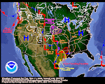
Well, I reckon that Snake Bite graphic I put up a few days ago worked out pretty good. There's a Mid Winter Break coming to your local neighborhood motion picture theater real soon. Check this babble from the Pocatello NWS AFD today. (Note: the spelling of the word "chance" is Pocatello's--NOT mine!)
A MAJOR PATTERN CHANCE WILL TAKE PLACE AS THE PATTERN WE SAW EARLIER IN THE FALL WITH A RIDGE ALONG THE COAST AND A TROUGH EAST OF THE ROCKIES RETURNS. LONG TERM...SATURDAY NIGHT THROUGH THURSDAY. LARGE BLOCKING RIDGE OF HIGH PRESSURE WILL BE THE DOMINATING WEATHER FEATURE THROUGH NEXT WEEK. THE BIG QUESTION WILL BE WHERE THE POSITION OF THE RIDGE AXIS LIES IN RELATION TO EASTERN IDAHO. MODELS KEEP THE AXIS JUST OFF THE PACIFIC COAST FOR THE BULK OF LONG TERM AND AS A RESULT...THE BEST MOISTURE AND INSTABILITY MOVING ALONG THE JET WILL REMAIN NORTH AND EAST OF THE FORECAST AREA.
The farther south you get the more enthusiastic the NWS people are about this whole gig. It looks like the Real Deal, as they say. However, as we said in at least one of our previous posts, don't let your guard down--winter ain't gone. Nope, it'll be BAAAACK! And when it comes, it's coming with a real vengeance and an really BAD attitude. Enjoy this Mid-Winter Break--you deserve it!
January 8, 2009
Subscribe to:
Post Comments (Atom)


1 comment:
Yes. Ahhh...Big sigh of relief! Weather is clear, mild, and gorgeous today! Thank you, John P. for sending blissful weather our way!
~The folks in inner mountain Idaho
Post a Comment