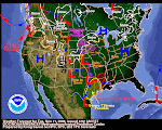
It's looking good for California. The five-day QPF paints at least a couple inches of water up and down The Golden State. NWS Staff in the various offices are beginning to chatter about upcoming events. We will cover this evolving event in greater detail tomorrow and in coming days. Here's a few choice words from the San Francisco AFD:
ACTIVE PATTERN SHAPING UP AS A PARADE OF SYSTEMS MARCH THROUGH THE WEST COAST...RAIN...LOCALLY HEAVY RAIN AND EVEN SNOW WILL BE POSSIBLE.
THE STORM DOOR WILL REMAIN WIDE OPEN FOR THE LONG TERM.
BOTH MEDIUM RANGE MODELS INDICATE A GOOD SWATH OF PRECIP WITH EASILY OVER AN INCH AND POSSIBLY UP TO TWO INCHES IN THE HILLS.
Take a look at the Navy's global composite and you'll see why they used the word "parade" in the AFD. It sure looks like that to me, too!
Idaho appears to be on the outside looking in on all this action. We might get a table crumb or two out of it. However, we're happy to see California is getting hit. They are in a world of hurt waterwise down there. They really, really NEED a LOT of water to help them cope during the upcoming dry season. Let's hope El Pacifico doesn't let them down.
February 10, 2009
Subscribe to:
Post Comments (Atom)


No comments:
Post a Comment