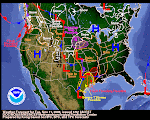
The Snake River Plain is in line for a wee little bit of precip today. Those "pointy thing" (AKA: the Tetons) to our East will probably get some nice powder out of the deal. The Navy's water vapor maps show a lot of moisture boogie-ing across the Pacific. The QPF people show some decent accumulations progged over the next five days. One of our Official Blog Followers is in the crosshairs of that QPF in Brookings, Oregon. He left a great comment about how the storm impacted their location. Please read it below. Thanks, Dean-O, we sure appreciate it a LOT! Keep 'em coming!

March continues to show hopeful signs of being a Precip Producer. We are now less than one month away from the official first day of Spring. Generally speaking, big winter storms decline in frequency and intensity after the Vernal Equinox. From that point forward, Old Sol is on a fast track to keep its appointment with the Summer Solstice a mere 90 days away. Enjoy these storms while you can--times, they are a changin'!
 The Snake River Plain is in line for a wee little bit of precip today. Those "pointy thing" (AKA: the Tetons) to our East will probably get some nice powder out of the deal. The Navy's water vapor maps show a lot of moisture boogie-ing across the Pacific. The QPF people show some decent accumulations progged over the next five days. One of our Official Blog Followers is in the crosshairs of that QPF in Brookings, Oregon. He left a great comment about how the storm impacted their location. Please read it below. Thanks, Dean-O, we sure appreciate it a LOT! Keep 'em coming!
 March continues to show hopeful signs of being a Precip Producer. We are now less than one month away from the official first day of Spring. Generally speaking, big winter storms decline in frequency and intensity after the Vernal Equinox. From that point forward, Old Sol is on a fast track to keep its appointment with the Summer Solstice a mere 90 days away. Enjoy these storms while you can--times, they are a changin'!


1 comment:
Greetings from Cape Ferello,Oregon. We are at about a 1000 feet of elv. and 2 miles from the ocean and are getting pounded once agane. In the last 24 hrs we have recived about 4 inches of rain, The temp has been 45 to 55. The winds are cooking at 35 to 45+ mph. and the trees are wipping. Its the kind of weather that wakes me up at night! The fun thing with storms like this is it realy gets the ocean kicking and thats so fun to watch. this storm is a slow mover (a cut off low?) And keeps bringing more of that wet stuff. In Brookings our precipitation totals since october are 41.42 inches, normal is 46.36. Up here on the side of a mountian we get a lot more wet stuff! around new years Brookings recived 6 inches and up the hill we got 15.8 inches! nice flooding action. hope your all doing great out there, peace,Dean-o
Post a Comment