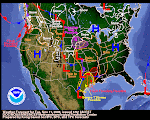
(Edited 27DEC) We roamed El Net on Christmas looking for "snow snippets."
We continue to look for little gems. on 27DEC we found this in a editorial by the Portland Oregonian newspaper: "...a storm rated as the region's worst in 40 years." The Portland NWS verifies this here.
The snippets below were the ones found on Christmas Day.
Here's a few we found in one single AP article:
"A blizzard warning for the San Juan mountains in southwest Colorado warned that as much as 3 feet of snow was possible."
"About 2 feet of snow fell overnight in the mountains around Lake Tahoe, bringing totals at some resorts in the past two weeks to 10 feet."
"Up to 18 inches of snow was possible in the Cascades; in the eastern half of the state Spokane, expected 5 to 7 inches of new snow atop a heavy layer that accumulated during weeks of storms."
From a a different source comes this gem:
"In Canada, meteorologists are predicting the first coast-to-coast white Christmas since 1971."
From Wisconsin media we learn:
"Wednesday's 2.9 inches of snow in Madison pushed the December total to 36.1 inches, breaking the December record of 35 inches set in 2000, the National Weather Service reported. The normal December total is 9.1 inches and last December's total was 26.4.
It also pushed the calendar year 2008 total to 106.8 inches, far above the old record of 82.6 inches in 1994.
The lone remaining record standing is the all-time monthly total of 37 inches set in February 1994.
And this from an agricultural publication:
"The snow depth at Claifornia's Big Bear Lake climbed to 54 inches. Big Bear Lake's greatest snow depth on record was 58 inches on February 3, 1979."
December 25, 2008
Subscribe to:
Post Comments (Atom)


No comments:
Post a Comment