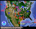
Arizona is progged to get the next slap in the face from this multi-faceted storm. Check this morning's Flagstaff warning:
SNOWFALL ACCUMULATIONS OF 12 TO 25 INCHES ARE EXPECTED BY LATE TUESDAY ACROSS THE KAIBAB PLATEAU AND THE SOUTH FACING SLOPES OF THE MOGOLLON RIM. EIGHT TO 16 INCHES ARE EXPECTED OVER THE YAVAPAI COUNTY MOUNTAINS...AND 6 TO 12 INCHES OVER BLACK MESA..DEFIANCE PLATEAU..CHUSKA MOUNTAINS..AND THE WHITE MOUNTAINS.
Lately, the weather forecasting industry has been crying wolf a tad too often. A blogger in Seattle coined this phenomena "snopocalypose." You can read her comments here.
One thing's fairly certain--federal snow measuring stations don't lie. They may malfunction but they don't lie or exaggerate. Use the SNOTEL link at left. Click on the state of your choice. Then click on the map's remote sensing site of your choice. Next, click on Snow Depth as reported hourly for the past 7 days. Scroll to the bottom of the data for the latest readings.
December 15, 2008
Subscribe to:
Post Comments (Atom)


1 comment:
So far at 8 AM Tuesday, Dec. 16, there are 12 to 14 inches on the ground in downtown Flagstaff and still coming down. This is a good one!
Post a Comment