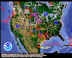
The sub-zero cold snap predicted actually materialized and we're sitting Sunday morning in the deep freeze. Actually, ten below ain't bad. What few hardy souls are left in Stanley are really shivering at -28! Temps will probably rise somewhat in the next day or two. We're progged for some snow Monday. The far Pac NW coast is due to get hit hard once again. Check this snippet from the morning Seattle AFD:
RAINFALL AMOUNTS OF 3 TO 6 INCHES IS POSSIBLE ON THE COAST AND IN THE CASCADES DURING THE TUE NIGHT THROUGH WED NIGHT TIME FRAME...WITH 8 TO 12 INCHES POSSIBLE ON THE SW FACING SLOPES OF THE CASCADES. THIS AMOUNT OF RAINFALL WOULD DRIVE MANY AREA RIVERS ABOVE FLOOD STAGE. THIS SITUATION BEARS CLOSE MONITORING.
In reading the various AFD's and looking at global water vapor patterns and the jetstream, I think we're going to get a classic "mid-winter break" beginning sometime around 10JAN, perhaps as late as 12JAN. Even the Climate Prediction Center has both the 6-10 and 8-14 days maps looking good--above normal temps and below normal precip. It's about time!
The key to our winter snowpack will unfold in late January and February. Last year, the snow pretty much stopped in early February. This year, I have a hunch, we might see some additional snow in the mid to late February timeframe. Water supplies are looking pretty good right now but we need to finish the job.
January 4, 2009
Subscribe to:
Post Comments (Atom)


No comments:
Post a Comment