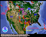
(See Sunday notes at end of post.)Well, what's in store for our future now that the high pressure is prepping to move east? There's no lack of Wazillas trying to knock down our doors. In fact, it appears that various pulses of water vapor coming out of Siberia are stacked up like airliners in a busy airport landing pattern. Currently the jetstream is largely zonal until its hits the high pressure wall. Once the high departs, the zonal flow will blow straight onshore along the Western US coast. Be sure to click the SST Map (sea Surface Temps) on your left. There's been an interesting anomaly developing in the heart of the Eastern Pacific. Currently, it's core is 2.59 degrees centigrade above normal. Keep an eye on this. Likewise, keep an eye on that east-west area west of South America that appears to be cooling rapidly. It could be a precursor of a weak resurgence of La Niña. It's obviously too early to tell right now but things are cooling down rapidly there. Watch it!
I suspect we haven't seen the last of the impacts of the summertime volcanic ash that's circulating in the Arctic latitudes. Even though it's been "hot" in Alaska lately, there's a lot of cold air om the arctic latitudes--very frigid up there! (See note below.) The winds in the Central Gulf of Alaska are medium stout right now but their are kicking up 18-20 waves. Check good ol' buoy 49001 to see for yourself.
This has been a wonderful mid-winter break--amazing in scope and power. It's ending soon--you can already see the patterns developing for its departure. Enjoy this weekend--get out and do something really unusual for January--because soon it's "back to the future" and the future is Winter! I'd guess we have 4-6 weeks more winter before the seasonal tilt of earth's axis loosens winter's grip on our latitudes.
Personally, I'm expecting another round of medium decent Pacific storms to begin to pulse ashore soon--building in intensity as the jetstream refocuses it's wrath on the western states. It's time to give the Midwest and the East Coast a well-deserved break! It's going to be our turn once again soon.
Well, that's about all I have to say about it tonight. Maybe tomorrow we will have some different thoughts. Thank you for reading and have a great and glorious weekend!
Sunday thoughts: The high is still there, looking perhaps even stronger. Click the Navy water vapor to see for yourself. Despite the warm chinook winds in Alaska, there still has to be some frigid air up in those latitudes. Consider this from Fairbanks: "The temperature never rose above 20 below for 16 straight days from Dec. 27 to Jan. 11. The low temperature was 40 below or colder on 14 of those days."
January 16, 2009
Subscribe to:
Post Comments (Atom)


2 comments:
Thanks a lot John. I am following from Africa. Awesome web page with links.
Not more storms! I was just getting used to the sun.
Post a Comment